Pages
Page 26
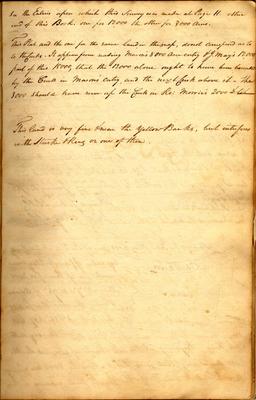
See the Entries upon which this Survey was made at Page 11. other end of this Book. one for 12,000 the other for 3000 Acres. This Plat and the one for the same land, in the map, do not correspond as to to the Creeks. It appears from reading Mason's 8000 acre entry & J. May's 12,000, part of this 15000, that the 12000 alone ought to have been bounded by the Creek in Mason's entry, and the next Creek above it - The 3000 should have run up the Creek in Ro: Morris's 2000 [struck: & to have]
This land is very fine & near the Yellow Banks, but interferes with Starke & King or one of them.
Page 27
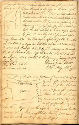
16 [sketch map] B A 1000 Surveyed for John May and Thomas Hughes 1000 acres of Land in Nelson County on a Preemption Warrant No 1142 lying on the waters of the Rolling Fork and Pleasant Run on both sides of the Hunters Trace and about 4 miles southwardly of Sadoskins Station and bounded as followeth, to wit, Beginning at an ash elm Dogwood and white oak the ash marked [TH?] about 40 poles southwardly from the said Hughes's Improvement and running thence N 70 E 320 Poles crossing a Creek at 94 Poles & another at 160 Poles to a Sugar Tree and three ash Trees N 20 W 500 Poles to a red oak Buckeye Ash and Dogwood standing on the west Bank of Pleasant Run S 70 W 320 Poles to a red oak and two Poplars S 20 E 500 Poles to the Beginning. January 12. 1786 Joseph Hughes Isaac Prichet } C.C. John Isaacs, Marker Burwell Jackson D.S.N.C. Will. May S.N.C.
--- [sketch map] Ohio River 6000 Surveyed for John May 6000 acres of Land in Nelson County by virtue of four Military Warrants one of them for 3000 acres No 730 as assee. of Adam Steven the other three for 1000 acres each No 626 _ 627 _ 628 as assee. of David Kenandy on the Ohio River _ Beginning at the upper corner of Samuel Beall's 2000 acre survey that joins Robert Morris's 2000 acre survey that lies at the mouth of the fourth Creek running into