Pages
stefansson-wrangel-09-27-001
47
CHAPTER V
The Planning of the Expedition
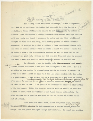
The sailing of our expedition for Wrangell Island in September, 1921, was due to the strong conviction that the world is at the dawn of a revolution in transportation ideas similar to that initiated heralded by Copernicus and Columbus. When the nations of Europe discovered four hundred years ago that the earth was round, they found it necessary to modify not only their intellectual concepts but also their diplomacy, their foreign policy and their commercial endeavors. It appeared to us that a similar, if less conspicuous, change would come when the nations realized that the earth is round from north to south from the point of view of the transportation engineer as well as from that of the astronomer and geodecist. Nations that had been far from each other as measured from east to west were about to become neighbours across the northern sea.
On a Mercator's map the Arctic looks like an area of vast extent, and seems to be located between continents on the south and nothingness on the north. But on a map which has the equator for circumference and the North Pole for center, the Arctic looks like a small hub from which the land masses radiate like the spokes of a great wheel. It may be said taht on a spherical world any point is central if we choose to consider it so. Mathematically that is right, but from the human point of view it That is specious reasoning, because for we inhabit the land and not the sea. It is possible to determine the center of distribution of the land masses. While this does not coincide with the Arctic, it does fall so near the Arctic that the validity of our figure remains undisturbed. The polar sea does hold a position analogous to that of the hub as related to the rest of a wheel.
There must have been a time, before navigation began, when from the practical point of view the Mediterranean was a barrier between, the peoples of Afica and Europe. But navigation developed through centuries. We cannot say in which
stefansson-wrangel-09-27-002
48
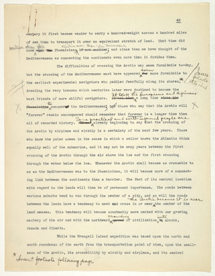
century it first became easier to carry a hundred-weight across a hundred miles of sea than to transport it over an equivalent stretch of land. That time did come earlier than the with the Phoenicians earlier even than the Minoaus; if not earlier and since then we have thought of the Mediterranean as connecting the continents even more than it divides them.
The difficulties of crossing the Arctic may seem formidable to-day, but the crossing of the Mediterranean must have appeared for even more formidable to the earliest experimental navigators who paddled fearfully along its shores; dreading the very breezes which centuries later were destined to become the best friends of more skilful navigators. It has been It took the Europeans and Africans a long time since the Phoenicians to conquered the Mediterranean; butthose who say that the Arctic will "forever" remain unconquered should remember that forever is a longer time than all of recorded history. We are Some practical and well-informed people are a1ready beginning to say that the crossing of the Arctic by airplane and airship is a certainty of the next few years. Those who know the polar ocean in the sense in which a sailor knows the Atlantic think equally well of the submarine, and it may not be many years between the first crossing of the Arctic through the air above the ice and the first crossing through the water below the ice. Whenever the Arctic shall become as crossable to us as the Mediterranean was to the Phoenicians, it will become more of a connecting link between the continents than a barrier. The fact of its central location with regard to the lands will then be of paramount importance. The roads between various suburbs tend to run through the center of a city, and so will the roads between the lands have a tendency to meet and cross in or near the Arctic because it is near the center of the land masses. This tendency will become constantly more marked with our growing mastery of the air and with the northward spread crawling of civilization in into Alaska, Canada and Siberia.
While the Wrangell Island expedition was based upon the north and south roundness of the earth from the transportation point of view, upon the smallness of the Arctic, its crossability by airship and airplane, and its central
stefansson-wrangel-09-27-003
footnote
Insert p. 48
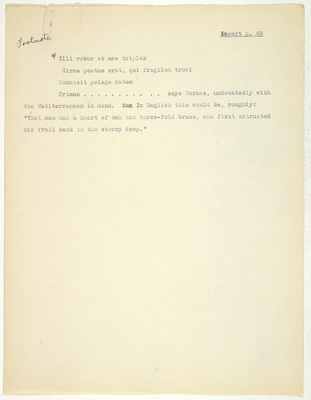
* Illi robur et aes triplex
Circa pectus erat, qui fragilem truci
Commisit pelago ratem
Primus .......... says Horace, undoubtedly with the Mediterranean in mind. xxx In English this would be, roughly: "That man had a heart of oak and three-fold brass, who first entrusted his frail bark to the stormy deep."
stefansson-wrangel-09-27-004
49
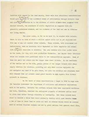
location with regard to the land masses, there were also subsidiary considerations based upon my historical study of the northward trend of civilization through historic time and upon my personal observation as to the mildness of arctic climate when compared with ancient beliefs, the abundance of arctic vegetation as compared with its generally postulated absence, and the richness of the land and sea in lifeless and living wealth.
The polar ocean, so far as we know it, is studded with islands. There is also an area of about a million square miles not as yet explored and this may or may not contain other islands. These islands, both discovered and undiscovered, have an intrinsic value dependent on their vegetable and animal life and upon their resources in minerals. The seas between will also confer value on the lands, for they will have productive fisheries. But beyond their intrinsic value the islands have positional value to the transportation engineer. Some of them are small but others are far larger than Great Britain. On the headlands of the smaller and on the wide, grassy plains of the larger islands will stand supply stations for airships, providing not only what routine equipment the air navigator may need if he gets there, but also the airships and airplanes that will respond like our present coast guard vessels to SOS signals from distant aircraft in distress.
On the basis of these considerations I began in 1919 to urge upon the Canadian Government the importance of continuous and extensive exploratory work in the Arctic. Hitherto the northern islands have been considered worthless and have, therefore, remained the undisputed property of whatever nation cared to claim them either through discovery or contiguity. Now these islands were about to receive a value that would gradually develop until some decades hence a few of them at least (and we could not tell in advance which) would be coveted much as certain tropical islands now are by great nations that quarrel about them.
stefansson-wrangel-09-27-005
50
During the last three hundred years the British have done as much northern exploration as all other European nations combined. Accordingly they had already the moral claim of discovery and exploration to most of the islands north of America and to some islands north of Asia. I argued it was important for Canada to continue the exploration of these islands and to do whatever was necessary to make it clear to the world that they valued them and intended to keep them permanently. It was also important to explore the areas thus far never traversed, both to accumulate information and to acquire discovery rights to any islands that might be found. I thought that five years probably, and ten years inevitably, would see the clear dawn of a normal popular understanding of the Arctic. Then would begin a possibly jealous competition among nations as to which could discover and claim the new islands and as to which had the right to hold permanently territoriesislands that had been so long neglected by their discoverers that they had become no-man's land, open for occupation by whatever country might prove sufficiently enterprising.
There were many in Canada who had views similar to mine, and several who were sufficiently interested to urge them upon the Government. Between us we spent an aggregate of weeks talking to Cabinet ministers and politicians, we wrote reams of semi-confidential letters of argument, we begged and implored. Then came the minor good fortune that one of the European nations through diplomatic channels cast some doubt upon the validity of Canadian claims to a certain "Canadian" arctic islands. This kindled interest, for it is human nature to want whatever someone else wants. The Government actually began to spend money, and the plans of an expedition on a great scale took shape.
Then arose a most unfortunate controversy as to who should be the controlling personality in these expeditions. Had there been a clear victory for one or the other of the two chief candidates, all might have been well. But the worst possible happened. An approximately equal support for each developed
