Pages
52. EXPLANATION OF THE MAPS.
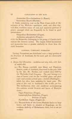
Ammonites Novo-Seelandicus (v. Hauer), inoceramus Haasti (Hochst.).
2. Strata containing coal in the West Coast, south of the entrance of the Waikato - standstone, marl, and slate clay, with thin, worthless seams of coal, and numerous portions of plants, amongst which are frequently to be found in good preservation: Polypodium Hochstetteri (Unger), Asplenium palæopteris (Unger); while the Belemnites (belonging to the group of Canaliculati) indicate the Jurassic system. The largely folded Inoceramus and Ammonites have a greater similarity to those from the chalk formation.
CAINOZOIC (TERTIARY) FORMATION.
Tertiary Formations are distributed over a large portion of the Province of Auckland, for the most part in a horizontal position.
1. Brown Coal Formation: sandstone and clay slate, with beds of useful coal. (a.) The Hunua coal-field, near Drury and Papakura district, south of Auckland, discovered in the year 1858 by the Rev. Mr Purchas, and worked since 1859 by the Waihoihoi Coal Company. The coal belongs to a class of brown coal - to the so-called glanz and pitch coal - and contains a fossil gum - Ambrit (Haidinger) - which has often been mistaken for kauri gum. The price of this coal in Auckland is 30s. to 32s. per ton. The argillaceous slate and sandstone accompanying this contains several bivalves and leaves of Dicotyledones: Fagus Ninnisiana (Unger), Lorantophyllum Griselinia (Unger), " Dubium (Unger) Myrtifolium lingua (Unger) &c. (b.) The coal-fields of the Lower Waikato basin - a large brown coal basin - is situated at Kupakupa, on the northern declivity of Hakarimata chain, but is not yet worked.
EXPLANATION OF THE MAPS. 53
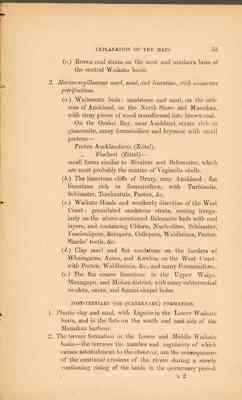
(c) Brown coal strata on the west and southern brim of the central Waikato basin.
2. Marine argillaceous marl, sand, and limestone, with numerous petrifactions. (a.) Waitemata beds: sandstone and marl, on the isthmus of Auckland, on the North Shore and Manukau, with stray pieces of wood transformed into brown coal. On the Orakei Bay, near Auckland, strat rich in glauconite, many foraminiferæ and bryozoæ with small pectens - Pecten Aucklandicus (Zittel), " Fischeri (Zittel) - small forms similar to Bivalves and Belemnites, which are most probably the centres of Vaginella shells. (b.) The limestone cliffs of Drury, near Auckland: flat limestone rich in foraminiferæ, with Turbinolia, Schizaster, Terebratula, Pecten, &c. (c.) Waikato Heads and southerly direction of the West Coast: granulated sandstone strata, resting irregularly on the above-mentioned Belemnite beds with coal layers, and containing Cidaris, Nucleolites, Schizaster, Fasciculipora, Retepora, Cellepora, Waldheima, Pecten Sharks' teeth, &c. (d.) Clay marl and flat sandstone on the borders of Whaingaroa, Aotea, and Kawhia, on the West Coast, with Pecten, Waldheimia, &c., and many Foraminiferes. (c.) The flat coarse limestone in the Upper Waipa, Maungapu, and Mokau district, with many subterrestrial rivulet, caves, and funnel-shaped holes.
POST-TERTIARY (OR QUARTERNARY) FORMATION.
1. Plastic clay and sand, with Lignite in the Lower Waikato basin, and in the flats on the south and east side of the Manukau harbour.
2. The terrace formation in the Lower and Middle Waikato basin - the terraces the number and regularity of which causes astonishment to the observer, are the consequences of the continual erosions of the rivers during a slowly continuing rising of the lands in the quarternary period. E2
54 EXPLANATION OF THE MAPS.
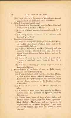
The Taupo district is the source of the extensive masses of pumice which are distributed over the terraces.
3. Littoral formation along the coast. (a.) Formation of downs mostly near the West Coast and on the Coast of the Bay of Plenty. (b.) Layers of titanic magnetic iron sand along the West (c.) Mud with bracksh sea animals in the estuaries of the East and West Coast.
4. Formation in the interior. (a.) Extensive swamps and peat bogs along the East Coast, the Middle and Lower Waikato basin, and on the entrance of the Waikato. (b.) Layers, with bones of the Moa (Dinornis), and Moa stones in swamps; alluvial deposits and caves in the Upper Waipa, Mokau, and Tuhua district, and on the East Coast. (c.) Layers of kauri gum in the northern part of the Province of Auckland, where formerly kauri forest existed. (d.) Alluvium containing gold in the neighbourhood of Coromandel harbour.
5. Accumulation by the hands of men, as shells, stones, bones, &c., over different districts. (a.) Heaps of shells of edible varieties - Cardium, Ostrea, Mytilus, Patella, Venus, Haliotis, Mesodesma, Turbo, Monodonta, &c. - particularly in the places of former pas and villages, analogous to the Kjokken moddings in Denmark. (b.) Stones of fire-places of the Maoris, charcoal, and ashes. (c.) A variety of tools made from stone by the Maoris, anchors, axes, &c., prepared of Aphanite, Nephrite, flintstone, &c. (d.) Human bones, bones of dogs, whales, fishes, and different birds - Penguin, Albatross, Weka (Ocydromus), Kiwi (Apterix), Moa bones, and egg shells, in the neighbourhood of the Maori fire-places. These bones are mostly burned, and bear the marks of stone weapons.
EXPLANATION OF THE MAPS. 55
VOLCANIC FORMATION.
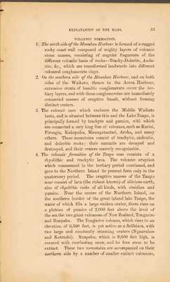
1. The north side of the Manukau Harbour is formed of a rugged rocky coast wall composed of mighty layers of volcanic stone masses, consisting of angular fragments of the different volcanic basis of rocks - Trachy-Dolerite, Andesite, &c., which are transformed landwards into different coloured conglomerate clays.
2. On the southern side of the Manukau Harbour, and on both sides of the Waikato, thence to the Aotea Harbour, extensive strata of basaltic conglomerate cover the tertiary layers, and with these conglomerates are immediately connected masses of eruptive basalt, without forming distinct craters.
3. The volcanic zone which encloses the Middle Waikato basin, and is situated between this and the Lake Taupo, is principally formed by trachyte and pumice, with which are connected a very long line of volcanos, such as Karioi, Pirongia, Kakepuku, Maungatautari, Aroha, and many others. These mountains consist of tracytic, andesitic, and doleritic rocks; their summits are decayed and destroyed, and their craters scarcely recognisable.
4. The volcanic formation of the Taupo zone consists of a rhyolithic and tracytic lava. The volcanic eruption which commenced in the tertiary period continued, and gave to the Northern Island its present form only in the qaternary period. The eruptive masses of the Taupo zone consist of lava (the richest known) of silicious earth, also of rhyolithic rocks of all kinds, with obsidian and pumice. Near the centre of the Northern Island, on the southern border of the great inland lake Taupo, the water of which fills a large sunken crater, there rises on a plateau of pumice of 2,000 feet above the level of the sea the two giant volcanoes of New Zealand, Tongariro and Ruapahu. The Tongariro volcano, which rises to an elevation of 6,500 feet, is yet active as a Solfatara, with two large and constantly steaming craters (Ngauruhoe and Ketetahi). Ruapahu, which is 9,000 feet high, is covered with everlasting snow, and its fires seem to be extinct. These two mountains are accompanied on their northern side by a number of smaller extinct volcanoes,
56 EXPLANATION OF THE MAPS.
which the natives have designated as the wives and children of the two giants.
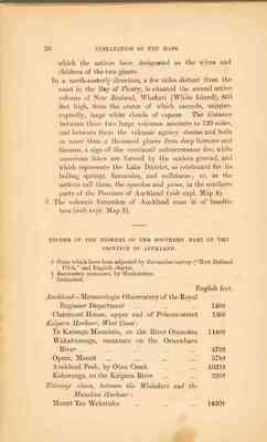
In a north- easterly direction, a few miles distant from the coast in the Bay of Plenty, is situated the second active volcano of New Zealand, Whakari (White Island), 863 feet high, from the crater of which ascends, uninteruptedly, large white clouds of vapour. The distance between these two large volcanos amounts to 120 miles, and between them the volcanic agency steams and boils in more than a thousand places from deep furrows and fissures, a sign of the continual subterraneous fire, while numerous lakes are formed by the sunken ground, and which represents the Lake District, so celebrated for its boiling springs, fumaroles, and solfataras; or, as the natives call them, the ngawhas and puias, in the southern parts of the Province of Auckland (vide expl. Map 4).
5. The volcanic formation of Auckland zone is of basaltic lava (vide expl. Map 3). _______________ RECORD OF THE HEIGHTS OF THE SOUTHERN PART OF THE PROVINCE OF AUCKLAND.
† Parts which have been adjusted by the marine survey ("New Zealand Pilot," and English charts). ɓ Barometric measures, by Hochstetter. * Estimated.
English feet. Auckland - Meterologic Observatory of the Royal Engineer Department ... ... ... ... ... 140† Claremont House, upper end of Princes Street 130ɓ Kaipara Hourbour, West Coast: Te Karanga Mountain, on the River Otamotea 1440† Wakakuranga, mountain on the Oruawharu River... ... ... ... ... ... ... ... 476† Opara, Mount .. ... ... ... ... ... ... 378† Auckland Peak, by Otau Creek ... ... ... ... 1023† Koharanga, on the Kaipara River ... ... ... 326† Titirangi chain, between the Waitakeri and the Manukau Harbour: Mount Tea Wekatuku ... ... ... ... ... 1430†
